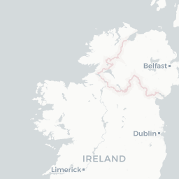
Ortelius Improved or a New Map of Ireland : Wherein are inserted, the Principal Families of Irish and English Extraction, who possess'd that Kingdon On the Commancement of the Seventeenth Century
Saved in:
Bibliographic Details
- Main Author
- Other Authors
- Document Type
- Maps
- Physical Description
- 1 mapa : mědirytina podlepená plátnem ; 86,5 x 82,5 cm na listu 92,5 x 88 cm, složeno na 45 x 47 cm
- Published
-
Dublin :
S.n.,
1795
- Subjects
- Item Description
- 44 Minutes of Time W from London. 11 Degreees West Longitude from London
Na zadní straně rukopisná poznámka: Spez. Invent. No. 7
Výzdoba: V levém horním rohu ozdobná nápisová kartuše, v mapovém rámci geografické souřadnice, souřadnicová síť - Scale
- Měřítko [ca 1:825 000]
- Citation/references
- IVRLA (Irish Virtual Research Library and Archive)